Earth Observation · Interactive
Ground Truth
Forty years of Earth, watched without blinking, and measured.
Since the 1980s, satellites have imaged the whole planet on a loop. That unbroken record lets you compress four decades of change into a few seconds, and pull the economic signal straight out of the pixels. Six places, six kinds of change. Scroll.
Scroll↓
The Planet difference
At three metres

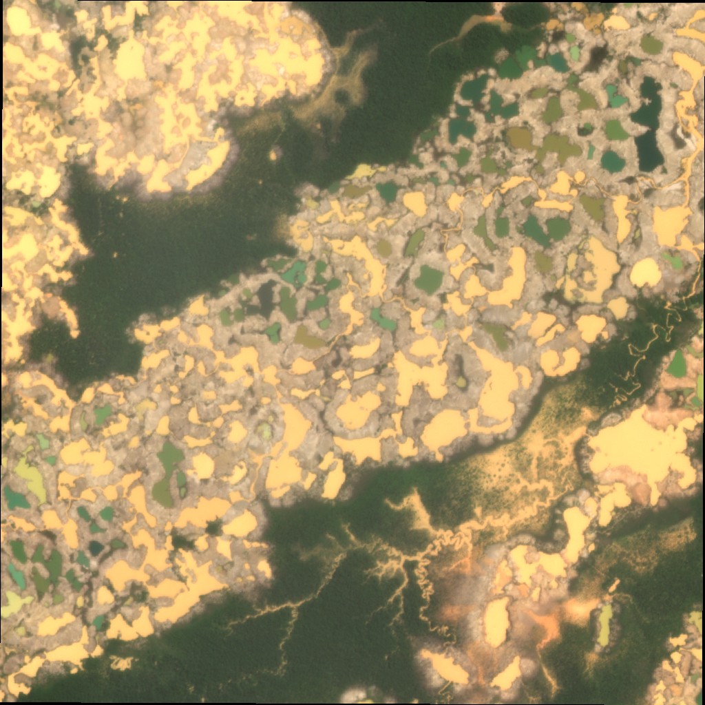
Illegal gold mining in Madre de Dios, Peru: rainforest stripped to bare earth and pocked with mercury ponds. The same place at Landsat's 30 m and Planet's 3 m. Drag to compare.
What it's worthGold prices drive the digging; at 3 m, daily, the spread shows up the week it happens, a physical-economy signal that doesn't wait for a quarterly report.
Planet imagery © 2023 Planet Labs PBC (PlanetScope Sandbox Data), processed by D. Balanzat and used under CC BY-NC 4.0, rendered via the Planet Insights Platform. Landsat 30 m: USGS/NASA (public domain) via the Microsoft Planetary Computer.
Six places. Millions more.
Every story here runs on free, open satellite imagery (four decades of Landsat), the public record that reaches back to the 1980s. What it can't do is reach back at high resolution, or update faster than about once a week.
That's the line where Planet begins: the largest daily Earth-observation archive ever built, at 3 metres. The history here is open data; the present, at this fidelity, is Planet's.
The operational companion: The Power Draw →